#soviet-meteorology
#soviet-meteorology
[ follow ]
#winter-storm #climate-change #journalism-funding #flooding #uk-weather #reproductive-rights #weather-warnings
fromFast Company
4 days agoSee it: Air temperatures and pollution around the world are captured in real time in these animated weather maps
We created Earth in Action to provide a lens into what's happening on our planet, as it happens. Whether it's something typical, like the current air temperature, or an extreme event like a major dust storm, we wanted to provide an opportunity for people to see them.
OMG science

#winter-storm


US news
fromFortune
2 months agoAs Winter Storm Fern barrels in, all eyes are on the Weather Channel. Its CEO is charting the company's next big forecast: growth | Fortune
A massive winter storm, Fern, threatens roughly 150 million Americans while the Weather Company provides critical weather information and faces audience and business pressure.
Canada news
fromwww.theguardian.com
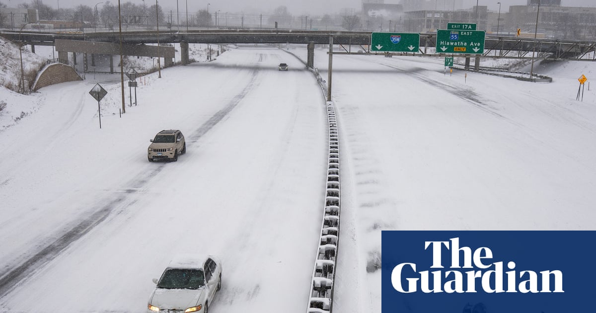
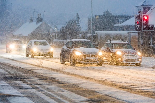
2 weeks agoWeather tracker: heavy snowfall and freezing rain sweep across US and Canada
A major winter storm is sweeping northeastern US and southeastern Canada, bringing heavy snow, freezing rain, strong winds, and a dangerous polar air mass with temperatures 10-25°C below seasonal average.

#uk-weather

UK news
fromwww.independent.co.uk
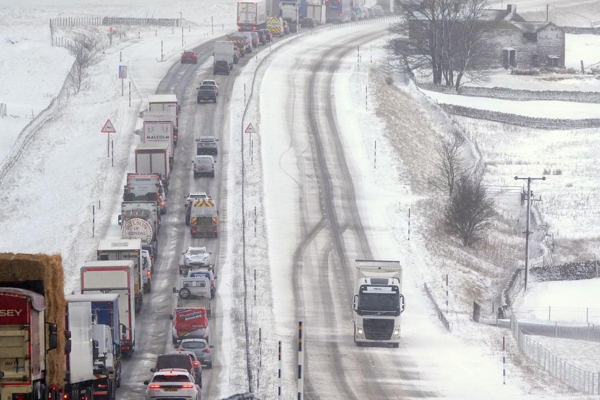
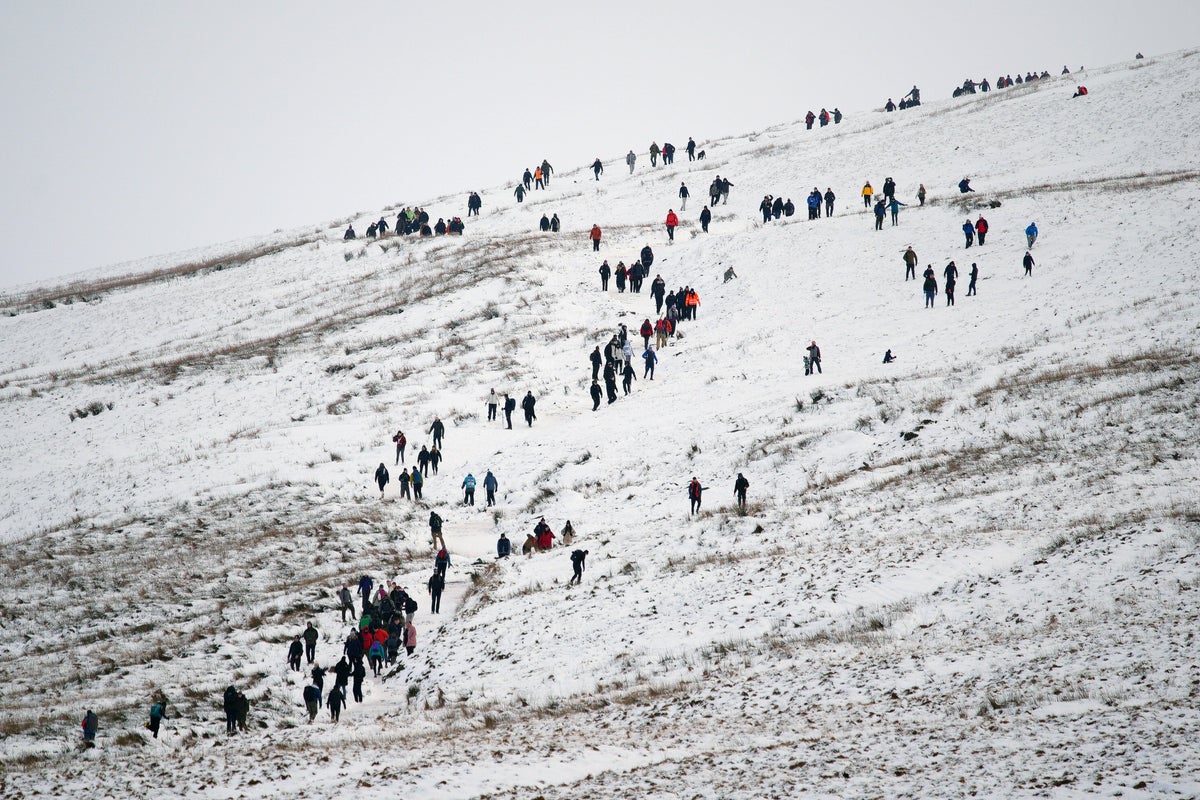
3 weeks agoUK weather: Where will see a sunny weekend after snow and wind warnings
The UK will experience sunshine and showers this week following severe snow and gale force winds, with temperatures dropping to 1-9°C and blustery conditions creating a chill despite occasional sunshine.
Data science
fromComputerWeekly.com
3 weeks agoMet Office 'supercomputing as a service' one year old | Computer Weekly
The Met Office's cloud-based supercomputing system from Microsoft achieved 100% availability for critical workloads over one year, delivering 60 quadrillion calculations per second with comparable latency to on-site infrastructure while offering greater flexibility and cost efficiency.
Science
fromNature
1 month agoThe first ice-core record of historical atmospheric hydrogen levels
Atmospheric hydrogen levels fluctuate with climate changes and have increased significantly since pre-industrial times due to human activities, requiring consideration in projections of future emissions impacts.
fromIrish Independent
1 month agoMet Eireann's new localised weather warning system aimed to be in place later this year
Met Éireann is progressing in the area of more localised weather warnings, via the use of polygons to represent areas under warnings. This will mean a move away from county-based warnings to a sub-county-based warning approach, which will identify where the expected impacts will be in the county.
Miscellaneous
California
fromLos Angeles Times
1 month agoLittle snow in California and the West as a warm winter nears end
California's Sierra Nevada snowpack remains at 66% of average despite February storms, with record warmth causing precipitation to fall as rain rather than snow, threatening water supplies across the West.
fromMail Online
1 month agoThink this is bad? Scientists warn Britain is about to get BLOOD RAIN
Britain is about to be hit with showers of 'blood rain', according to experts from the Copernicus Atmosphere Monitoring Service (CAMS). This is thanks to a plume of red Saharan dust, which is currently sweeping over Europe towards the UK. When this dust mixes with Britain's persistent rain, the precipitation will take on a distinctive reddish colour - creating a phenomenon known as 'blood rain'.
Miscellaneous
US politics
fromFuturism
2 months agoNational Weather Service Uses AI to Generate Forecasts, Accidentally Hallucinates Town With Dirty Joke Name
AI-generated weather graphics with hallucinated place names exposed staffing shortages and eroded public trust at the National Weather Service following major layoffs linked to DOGE.
fromwww.theguardian.com
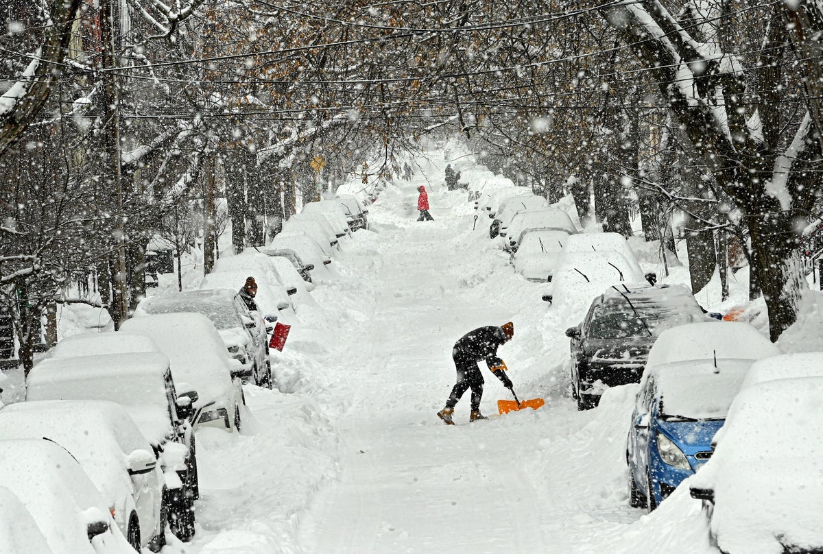
2 months agoWeather tracker: Record snowfall in eastern Russia leaves people stranded
A record-breaking snowfall event unfolded in far eastern Russia last week when the town of Petropavlovsk-Kamchatsky, located on the Kamchatka peninsula's east coast, received more than 1.8 metres (6 feet) of lying snow in places. Strong winds accompanying the snowfall caused extreme drifting of more than 3 metres against buildings and cars. Two key ingredients combined to cause such an extreme snowfall event. Strong Pacific low pressures dragged moist air from the tropics northwards, which clashed with cold Arctic air already over the region. Conveyor belts of tropical air are called atmospheric rivers and often bring heavy rainfall to places such as California.
Environment
fromBusiness Insider
2 months agoJust surviving the Arctic could be half the battle for NATO in a future war
SODANKYLÄ, Finland - Deep snow. Fleeting daylight. Wet clothes. Frozen weapons. Sub-zero temperatures. NATO soldiers training in Arctic warfare are learning that in a future conflict, fighting the enemy may be only half the battle. The other would be surviving the region's harsh winters. "The environment can be hard for someone who is not used to it," said Finnish Lt. Laura Lähdekorpi, bundled up and dressed in camouflage to blend in with the snow.
Careers
fromZDNET
2 months agoForget your weather app: 15 reliable meteorologists and other sources for accurate ice storm updates
If you've ever glanced at your phone's weather app to check the day's forecast or to help plan for an upcoming storm, you've probably run across a scenario where you see an outrageous forecast. It happened to me earlier this week when I noticed my app was predicting more than 13 inches of snow for the Charlotte, NC area. Not only would that be a historic storm, but it would also be fairly apocalyptic for an area where even an inch of snow is a rarity.
Science
Artificial intelligence
fromTechCrunch
2 months agoNvidia's new AI weather models probably saw this storm coming weeks ago | TechCrunch
Nvidia released Earth-2 AI weather models claiming faster, more accurate forecasts; Earth-2 Medium Range reportedly outperforms Google DeepMind's GenCast on over 70 variables.
France news
fromwww.theguardian.com
2 months agoSix people die as snow, ice and freezing temperatures wreak havoc in Europe
Severe winter weather across Europe caused at least six deaths, heavy snowfall, subzero temperatures, widespread travel disruptions, airport closures, and suspended rail services.
fromwww.npr.org
2 months agoFAQ: What is wind chill, and why is it dangerous?
Wind chill is a measure of how quickly bodies lose heat when you combine low temperatures with high winds. And wind chill conditions can be dangerous. "The stronger the winds [and] the colder it is, the more likely you are to develop frostbite in a short amount of time or hypothermia," says Jessica Lee of the National Weather Service's Weather Prediction Center.
Public health
World news
fromwww.theguardian.com
1 month agoWeather tracker: tropical cyclones hit Australia and Madagascar and -40C cold snap in northern Europe
Concurrent tropical cyclones caused severe coastal damage and flooding in Western Australia and Madagascar while Europe experienced contrasting wet and cold weather extremes.


fromwww.cbc.ca
2 months agoBrace, Toronto: Heavy snowfall could impact Wednesday morning commute | CBC News
A heavy snowfall warning is in place for Toronto with 10 centimetres of snow expected to affect the morning commute on Wednesday, according to Environment Canada. Residents are urged to plan ahead with extra time for travel due to poor visibility from the heavy and blowing snow, said the national weather agency in a yellow snowfall warning issued late Tuesday afternoon.
Canada news
Environment
fromwww.mercurynews.com
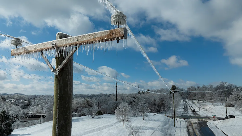
2 months agoMeteorologists blame a stretched polar vortex, moisture, lack of sea ice for dangerous winter blast
Warm Arctic waters and cold land are elongating the polar vortex, bringing subzero temperatures, heavy snow, and crippling ice across much of the United States.
fromFuturism
2 months agoEntire City Buried by Epic Snow
Consider the Kamchatka Peninsula, a Russian territory that reaches into the Pacific Ocean north-east of Japan, which has been battling with record amounts of snow this winter. On January 16 alone, a small city on the peninsula's southern coast, called Petropavlovsk-Kamchatskiy, experienced a baffling five and a half feet of snow, effectively burying local residents and their cars completely. Some areas saw more than six and a half feet in just the first half of January.
World news

Miscellaneous
fromIrish Independent
1 month agoMore counties added to snow, rain and wind warnings as Met Eireann forecasts further flooding
Multiple Status Yellow warnings for wind, rainfall and rain-snow across many Irish counties warn of flooding, travel disruption, fallen trees and high river levels.
fromSnowBrains
1 month agoAlaska, A Place Known for Massive Snow Totals, Records Snowiest January in Recorded History - SnowBrains
Recently, Anchorage, Alaska's largest city with nearly 400,000 residents, has just recorded its snowiest January on record. Tucked in between the mighty Cook Inlet and pushed right up against the Chugach Mountains, Anchorage sits in prime location for some serious snow totals. Moisture from pacific storms builds up over the inlet, and thanks to orographic lift caused by the mountains, forces that moisture to drop over Anchorage. Thanks to Alaska's northernly location, that moisture often falls in the form of snow.
Snowboarding
fromwww.npr.org
1 month ago'Please inform your friends': The quest to make weather warnings universal
In November 2025, a massive storm rolled across the lower Mekong River delta, dumping multiple inches of rain onto the wide, flat river plain that covers much of Cambodia. The river rose and rose. The force of the water churned up mud from the river bottom. The muddy water flowed downstream and rushed into the many farming and fishing towns that line the Mekong's banks.
US news

fromIrish Independent
1 month agoMet Eireann issues snow, wind and rain warnings for 12 counties with more flooding and disruption forecast
Wexford, Wicklow, Dublin, Meath and Louth will be under a Status Yellow wind warning and Met Éireann are warning of fallen trees and loose debris, as well as difficult travelling conditions associated with this warning. Counties Cork, Waterford, Carlow, Kilkenny, Wexford, Wicklow, and Dublin will be under also be under a Status Yellow rain warning and these counties can expect flooding, poor visibility and difficult travel conditions for the 24-hour period.
Miscellaneous
Environment
fromLondon Business News | Londonlovesbusiness.com
2 months agoMet Office issues further snow and ice warnings - London Business News | Londonlovesbusiness.com
Arctic airmass will keep the UK very cold with widespread snow, ice, hail, weather warnings and temperatures plunging below −10°C in places.
fromSnowBrains
2 months agoNASA: Satellite Image Shows Kamchatka, Russia, Buried by 19 Feet of Snow - SnowBrains
It has been an eventful few months for the Northern Hemisphere atmosphere. An unusually early sudden stratospheric warming episode in late November appears to have factored into a weakened and distorted polar vortex at times in December, likely causing extra waviness in the polar jet stream. This helped fuel extensive intrusions of frigid air into the mid-latitudes, contributing to cold snaps in North America, Europe, and Asia, and priming the atmosphere for disruptive winter storms in January.
Snowboarding
fromSilicon Canals
1 month ago7 weather warning signs your grandparents knew that meteorologists now confirm are accurate - Silicon Canals
Growing up outside Manchester, I spent countless summer holidays at my grandparents' farm in the Yorkshire Dales. My grandfather would step outside each morning, scan the sky, and announce with absolute certainty what the weather would do that day. No smartphone apps, no weather channel, just decades of observation. I used to think it was nonsense. How could watching birds or looking at clouds possibly compete with satellite technology? But here's the thing: he was almost always right.
Science
fromwww.theguardian.com
1 month agoNo end in sight' to Britain's wet weather as dozens of flood warnings issued
The Environment Agency (EA) has issued 85 warnings for England, meaning flooding is expected, mainly concentrated in the south-west and Midlands. A further 245 flood alerts are in place, meaning flooding is possible, from North Yorkshire to Cornwall and from the Welsh borders to Norfolk. Natural Resources Wales has another 11 flood alerts in place while Scotland has one flood warning and five flood alerts.
Environment
fromFuturism
2 months agoScientists Scramble to Set Up Outpost on Rapidly Melting Glacier
During a rare break in the weather, the NYT says helicopters airlifted the researchers and their equipment 19 miles to their planned outpost site on top of the glacier. The two helicopters involved flew a dozen total loads of cargo from the icebreaker ship to the camp site, while glacial scientists and engineers erected a small tent city, complete with bathrooms, generators, and a mess hall.
Environment
Environment
fromLondon Business News | Londonlovesbusiness.com
2 months agoMet Office warns of a 'multi-hazard' event - London Business News | Londonlovesbusiness.com
Severe winter warnings continue across the UK, with snow, ice and strong winds expected, especially in Scotland, northern England, Wales and the southwest.
fromThe Mercury News
1 month agoAnticipated rain will bring end to Bay Area's dry pattern
The pattern change began Monday when the barometric pressure surrounding the region started to fall gradually. That increase in low pressure is coming from the southwest and the air is flowing north, opposite of many winter low-pressure systems that dip in from the Pacific Northwest. As a result, light but steady rain is expected to start in Monterey County and the Central Coast late Tuesday morning. The rain is expected to reach the region closer to San Francisco sometime Tuesday night, Murdock said.
Environment
[ Load more ]