#western-iowa-weather
#western-iowa-weather
[ follow ]
#winter-storm #severe-weather #flooding #power-outages #travel-disruptions #tornadoes #travel-disruption


#winter-storm


Canada news
fromwww.theguardian.com
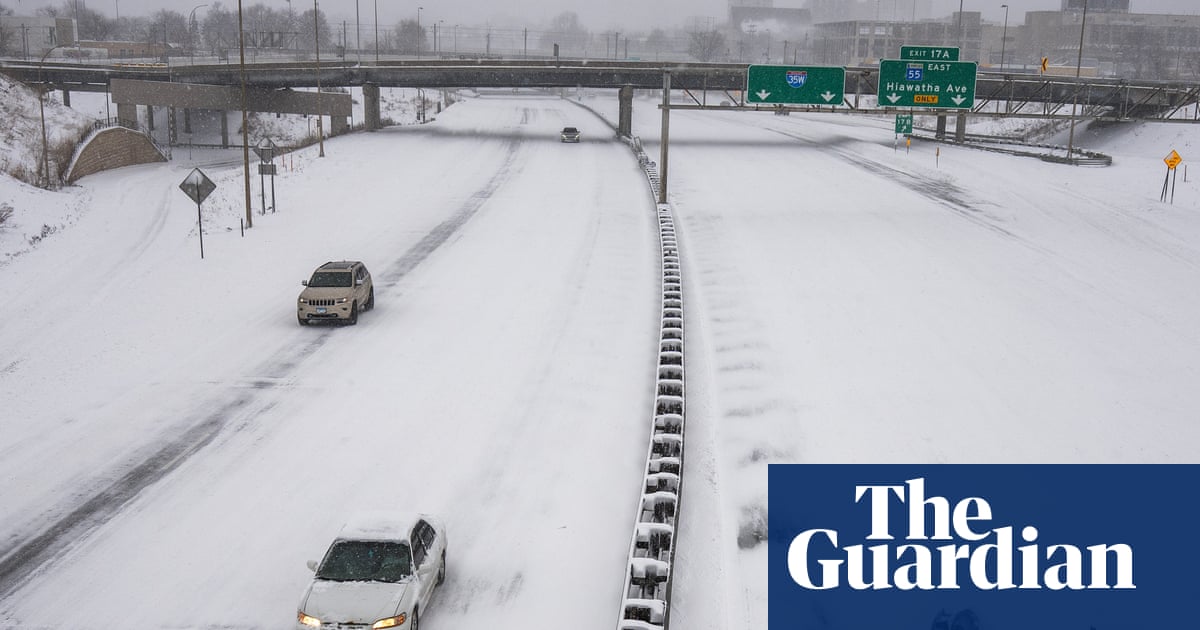
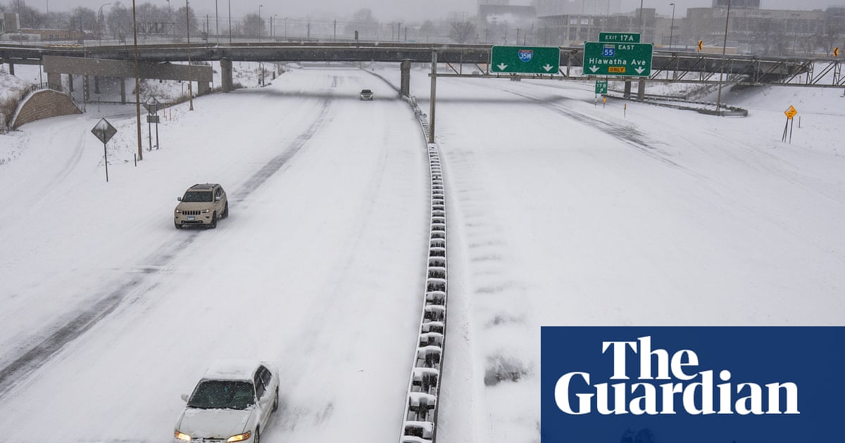
2 weeks agoWeather tracker: heavy snowfall and freezing rain sweep across US and Canada
A major winter storm is sweeping northeastern US and southeastern Canada, bringing heavy snow, freezing rain, strong winds, and a dangerous polar air mass with temperatures 10-25°C below seasonal average.
US news
fromwww.theguardian.com
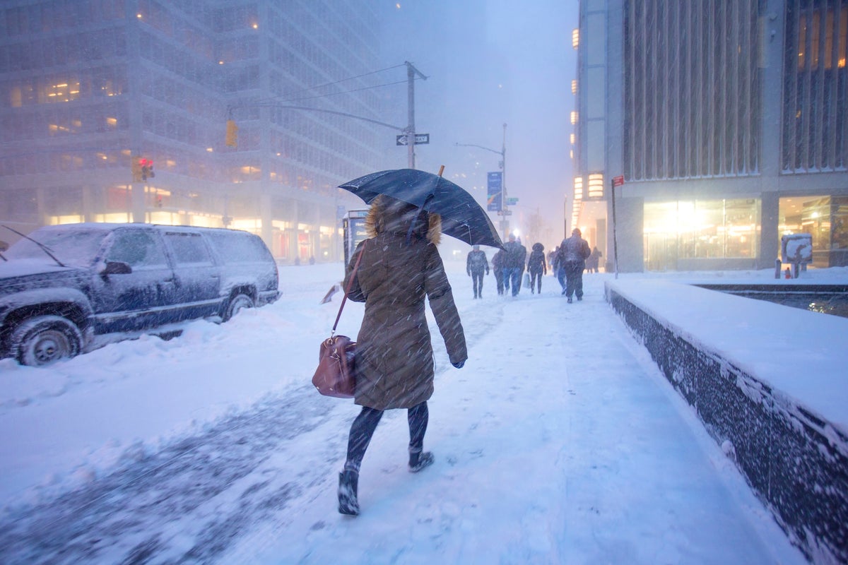
2 weeks agoThousands of flights canceled as winter storm marches across US
A late winter storm across the eastern US caused thousands of flight cancellations and delays, affecting over 200 million people with severe weather ranging from blizzards to tornadoes and record heat.

#severe-weather

US news
fromwww.theguardian.com
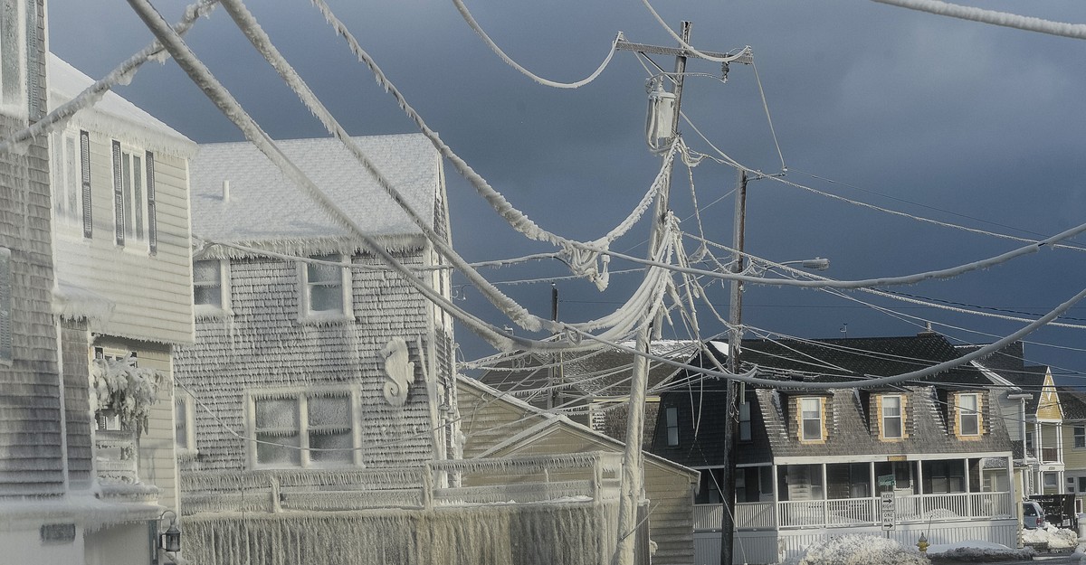
2 weeks agoTriple-threat megastorm' to scatter snow, high winds and thunder across US
A major March megastorm will impact nearly 200 million Americans with severe snow, damaging winds, tornadoes, and flooding, ranking among the most impactful US weather events of the year.


Environment
fromwww.scientificamerican.com
2 weeks agoNebraska is battling its largest wildfires in history. Worse may be yet to come
Nebraska experiences its largest wildfires in history, burning 800,000 acres with at least one death, driven by extreme heat, low humidity, high winds, and severe drought.
Chicago
fromwww.aljazeera.com
3 weeks agoTwo killed as tornadoes sweep across US Midwest in latest extreme weather
Supercell thunderstorms struck Illinois and Indiana, producing at least four tornadoes that killed two people and injured nine others, with extensive infrastructure damage across the region.


Environment
fromwww.scientificamerican.com
3 weeks agoNo U.S. states had a record cold winter. Nine had a record hot one
Despite eastern U.S. cold perceptions, the 2025-2026 winter was the second-warmest on record nationally, with nine western states experiencing record heat and zero U.S. locations recording record cold.
fromRealagriculture
3 weeks agoMarch WASDE leaves grain markets searching for direction
USDA estimates for major crops were largely unchanged from the previous month, resulting in muted market reactions. For wheat, the USDA maintained its U.S. production, supply, and ending stocks forecasts with no revisions. Global wheat production was adjusted slightly higher, largely due to increased output estimates in Ukraine and Kazakhstan, partially offset by a smaller Australian crop.
Agriculture


Chicago
fromMail Online
3 weeks agoMillions across 10 US states brace for 'severe' tornado outbreak
Nearly 80 million Americans face severe weather risk Tuesday, with the greatest tornado threat centered in northern and central Illinois and northwest Indiana, potentially producing strong to intense tornadoes with winds exceeding 110 mph.
US news
fromFortune
3 weeks agoThe weather sampler platter will wallop the U.S. this week: extreme heat in the south, downpours and snow in the east-with a side of the polar vortex | Fortune
Nearly all U.S. regions face extreme weather including record heat in the Southwest, snow in the Great Lakes, Arctic cold in the Midwest and East, and heavy rain in Hawaii within the coming days.
fromSnowBrains
3 weeks agoSnowBrains Forecast: 2 Feet Plus in the Midwest Through Tuesday - SnowBrains
Sunday and Monday bring the main event, and the models are tightly converged on a long-duration storm with heavy snow, strong northeast to north winds, and the best totals centered on northern Wisconsin and northern Lower Michigan. The main spread is not storm timing but exactly where the most intense band parks and how much the snow densifies Sunday afternoon, especially at the lower Michigan and southern Wisconsin hills.
Snowboarding
Agriculture
fromRealagriculture
3 weeks agoWheat School: What long-term weather trends say about the future of wheat production
Rising nighttime temperatures in the Northern Plains and Western Canada reduce wheat yield potential despite increased CO2 benefits, though improved genetics currently offset climate impacts.
Snowboarding
fromSnowBrains
3 weeks agoSnowBrains Forecast: Windy Friday, Then Up to 3 Feet in the Midwest by Tuesday - SnowBrains
A major Saturday night through Monday storm will bring 15-34 inches of snow across the Midwest and northern Lower Michigan ski areas, with Friday's clipper providing 3-7 inches of wind-worked snow before conditions improve midweek.
Agriculture
fromRealagriculture
3 weeks agoRealAg Radio: Growing wheat in hotter summers, Alto rail pushback & aphanomyces economics, Mar 9/26
RealAg Radio's Agronomic Monday episode covers palmer amaranth control, wheat adaptation to heat, herbicide options, rail infrastructure impacts on farming, and aphanomyces economics with expert guests from agricultural institutions and organizations.
fromIrish Independent
1 month agoMet Eireann's new localised weather warning system aimed to be in place later this year
Met Éireann is progressing in the area of more localised weather warnings, via the use of polygons to represent areas under warnings. This will mean a move away from county-based warnings to a sub-county-based warning approach, which will identify where the expected impacts will be in the county.
Miscellaneous
US news
fromwww.bostonherald.com
1 month agoMillions of Americans under threat of tornadoes as spring storm season kicks in early in the US
A major spring storm outbreak threatens millions across the heartland from Texas to Iowa, with the strongest severe weather and tornadoes expected Friday in Oklahoma, Kansas, and Missouri.
Agriculture
fromRealagriculture
1 month agoRealAg Radio: Meteorological spring, sulphur management, and new variety considerations, Mar 2, 2026
Agronomic Monday covers meteorological spring, maple syrup season, DON risk in corn, sulphur management, wheat variety considerations, and risk management strategies for farm operations.


Miscellaneous
fromIrish Independent
1 month agoConcern mounts over impact of incessant rainfall as unsettled weather to extend into March
Persistent heavy rainfall across Ireland has saturated farmland, disrupted farming operations and storage, increased flood risk, and may delay planting and harm harvests.

Environment
fromIrish Independent
1 month agoSnow and ice for some counties ahead of latest weather warnings for 17 counties and likely flooding
Status Yellow wind, rainfall and rain-snow warnings affect multiple Irish counties from late Tuesday to Wednesday, with flooding, travel disruption and high river levels expected.
Miscellaneous
fromIrish Independent
1 month agoWinter to bite hard as ice, frost and snow forecast over next four days; and two counties hit with last-minute rain warning
Widespread freezing temperatures, ice and possible snow will affect Ireland with Status Yellow alerts, travel hazards expected, and temperatures falling as low as -5C.
fromIrish Independent
1 month agoMet Eireann issues snow, wind and rain warnings for 12 counties with more flooding and disruption forecast
Wexford, Wicklow, Dublin, Meath and Louth will be under a Status Yellow wind warning and Met Éireann are warning of fallen trees and loose debris, as well as difficult travelling conditions associated with this warning. Counties Cork, Waterford, Carlow, Kilkenny, Wexford, Wicklow, and Dublin will be under also be under a Status Yellow rain warning and these counties can expect flooding, poor visibility and difficult travel conditions for the 24-hour period.
Miscellaneous
Agriculture
fromRealagriculture
1 month agoHeavy wheat stocks and hope on canola - where Prairie grain markets stand ahead of seeding
Global grain supplies are heavy, squeezing cereal margins, while canola and select pulse markets show firmer signals and Canada's wheat balance is comparatively tighter.
Miscellaneous
fromIrish Independent
1 month agoWinter to bite hard as ice, frost and snow forecast; severe flooding disruption as two counties hit with last-minute rain warning
Widespread freezing conditions, with temperatures down to -5C in places, will cause ice, travel hazards and flooding under Status Yellow alerts across Ireland.
fromIrish Independent
2 months agoStorm Chandra: Heavy rain and strong winds forecast, as weather warnings in place for more than a dozen counties
Met Éireann has issued weather warnings for 13 counties, saying bands of rain from Storm Chandra will be "heavy and persistent". The Status Yellow rain warning for Carlow, Kilkenny, Louth, Wexford, Wicklow and Waterford are due to end at 11pm on Tuesday. Forecasters also issued a Status Yellow wind warning for Cork, Kerry, Waterford, Dublin, Louth, Wexford, Kilkenny, Wicklow, Carlow, Meath, Kildare, Monaghan and Cavan. The warnings will also be in effect until 11pm on Tuesday.
Miscellaneous

Agriculture
fromRealagriculture
2 months agoRealAg Radio: Weather impacts on profitability, lodging concerns, and cereal nutrition, Feb. 2, 2026
Weather strongly influences farm profitability, increases lodging risk in cereals, and requires targeted cereal nutrition and improved genetics to protect yield and quality.
Miscellaneous
fromIrish Independent
2 months agoMet Eireann issues warning of more flooding to come as rain forecast for 'saturated ground'
Saturated ground and a potential next-week weather system could cause surface, river and coastal flooding in multiple Irish counties; authorities urge vigilance and offer assistance.
fromIrish Independent
1 month agoMet Eireann changes Orange and Yellow rain warnings for 13 counties as flood threat peaks and travel disruption hits
LATEST: More homes and businesses at risk as flood threat to peak this morning Series of Status Orange and Yellow warnings in place Coast Guard has asked public to stay away from waterways and exposed coastal areas Some schools may close today as flooding may affect transport The threat of flooding is set to peak this morning, with road networks expected to bear the brunt of the deluge. However, damage to residential and commercial properties is also likely, emergency services have warned.
Miscellaneous
fromIrish Independent
1 month agoSevere flooding disruption as forecasters issue last-minute rain warning; winter to bite hard as ice, frost and snow due in coming days
"It will prove cold with some frost and ice in places on Friday morning, especially in the west and north," she said. "Munster and south Leinster will see cloud, but that will clear to leave dry and sunny conditions with a few isolated showers in the north and highest temperatures of 3C to 7C," she said. Friday night will prove mainly dry but very cold and frosty with some icy patches.
Environment
[ Load more ]