#western-snowpack
#western-snowpack
[ follow ]


fromwww.theguardian.com
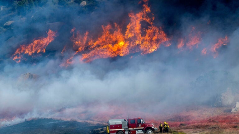
1 day agoEvacuations as two wildfires break out in southern California
The Springs fire in Riverside county has grown to 3,500 acres, prompting local authorities to issue several evacuation orders. The fire is concentrated in an area mostly north and east of Lake Perris, burning portions of the surrounding state recreation area.
East Bay (California)


fromSnowBrains
2 days agoLate Season Storm Brings Welcome Conditions Refresh to Mt. Rose Ski Tahoe, NV - SnowBrains
"We're always glad to welcome winter back, and this latest round of snow has ensured there are still great turns to be had as our spring season continues. Late season powder days are a bonus, and with the spring events and deals we have planned, it's not too late to get up here for some great skiing and riding!" - Mike Pierce, Marketing Director, Mt. Rose Ski Tahoe
Snowboarding
Skiing
fromABC7 San Francisco
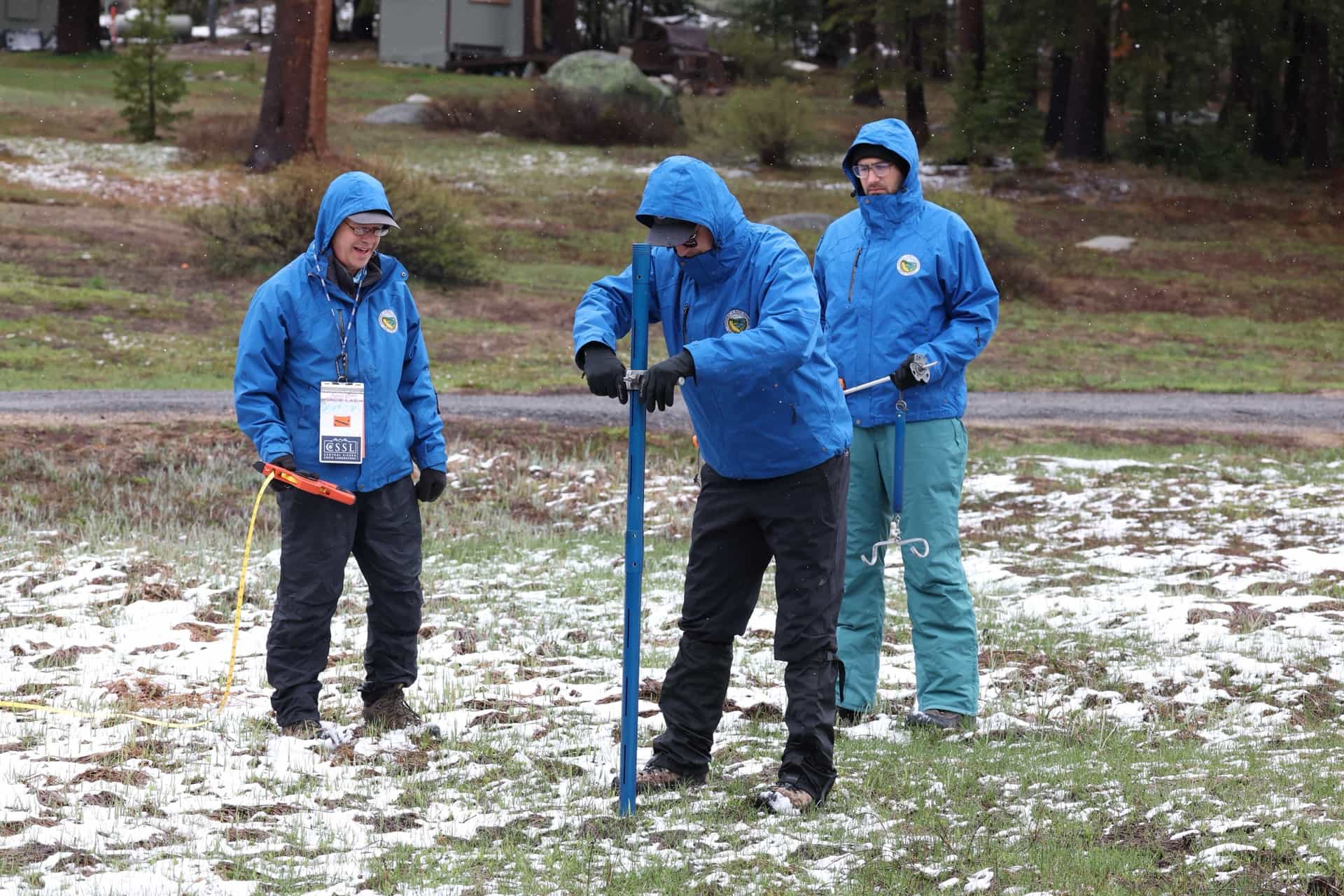
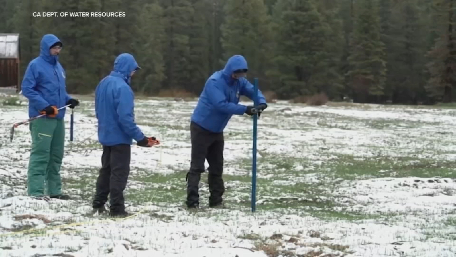
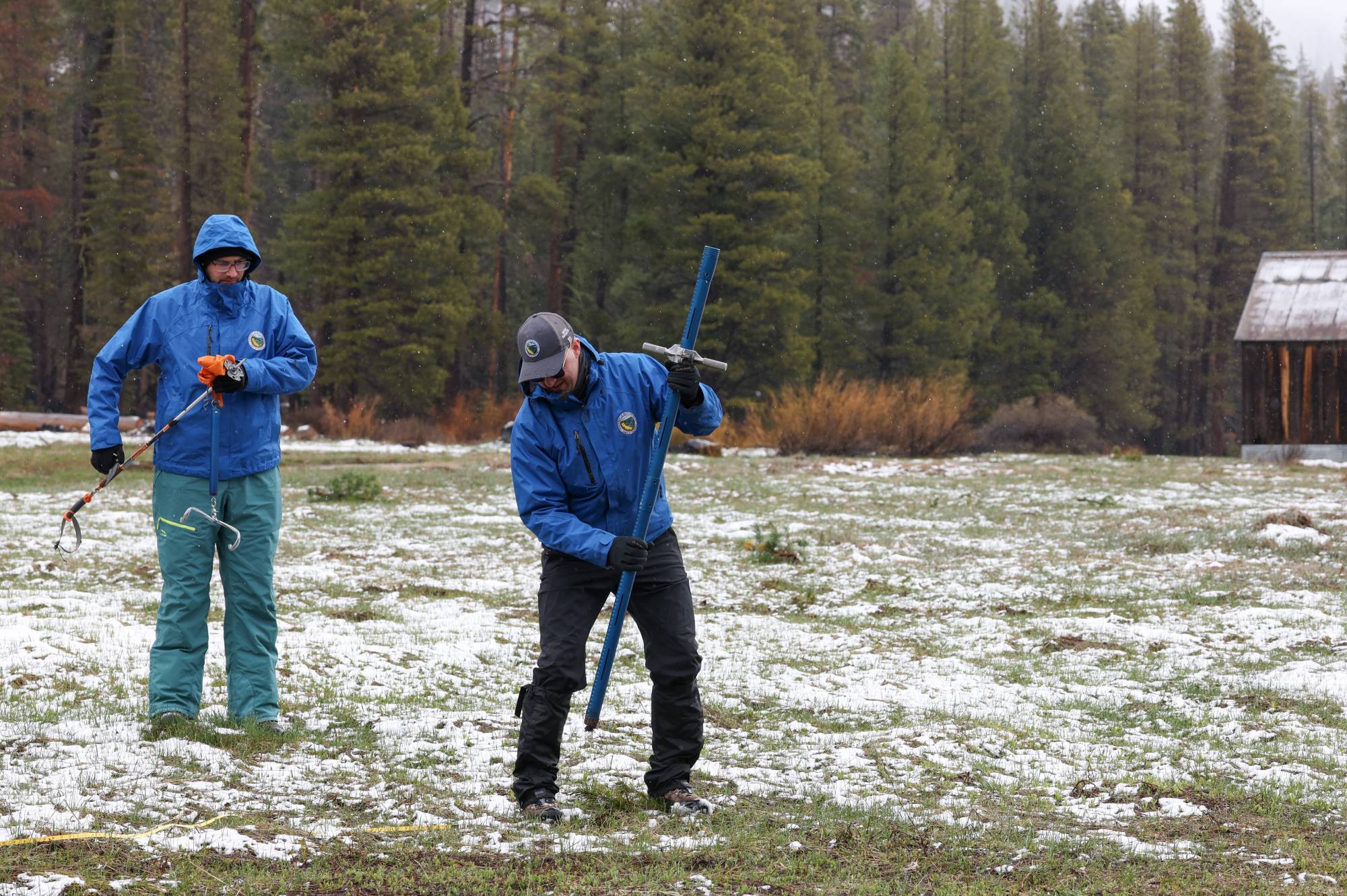
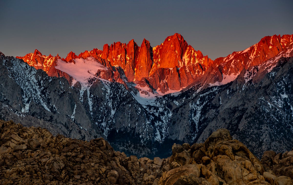
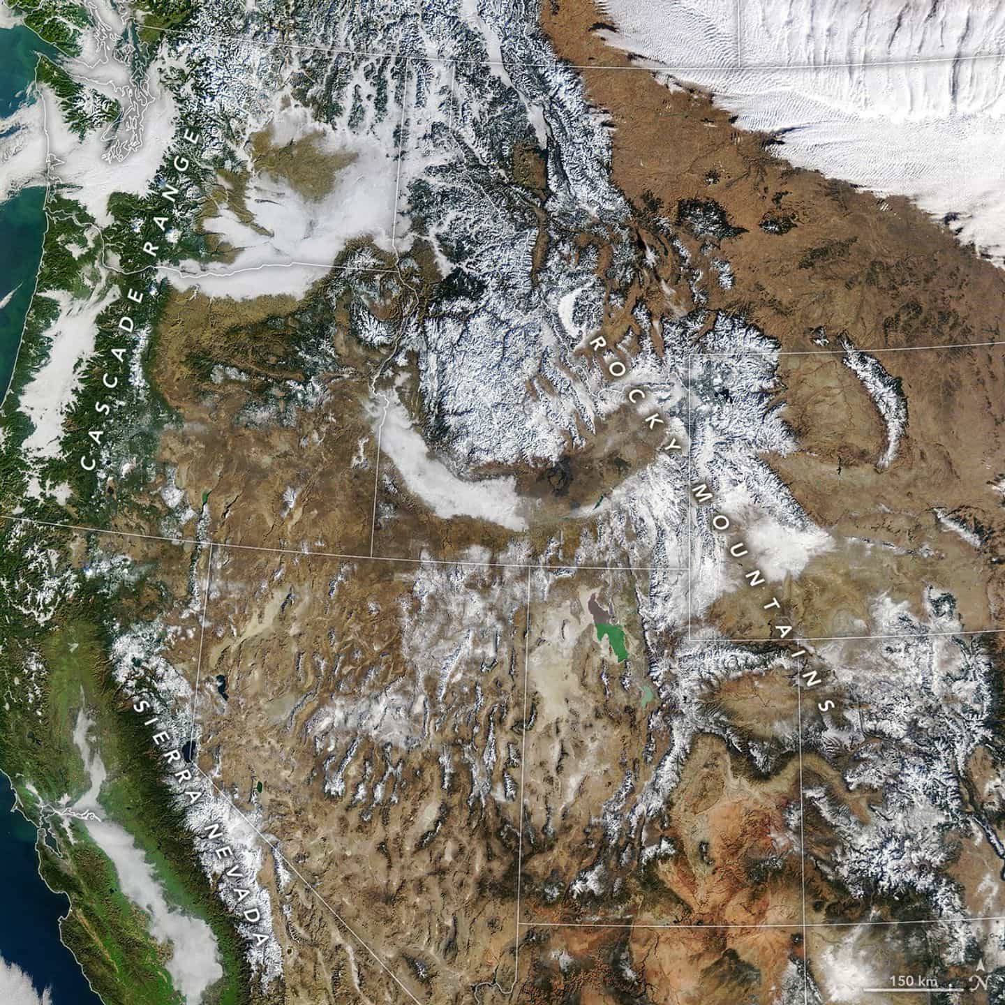
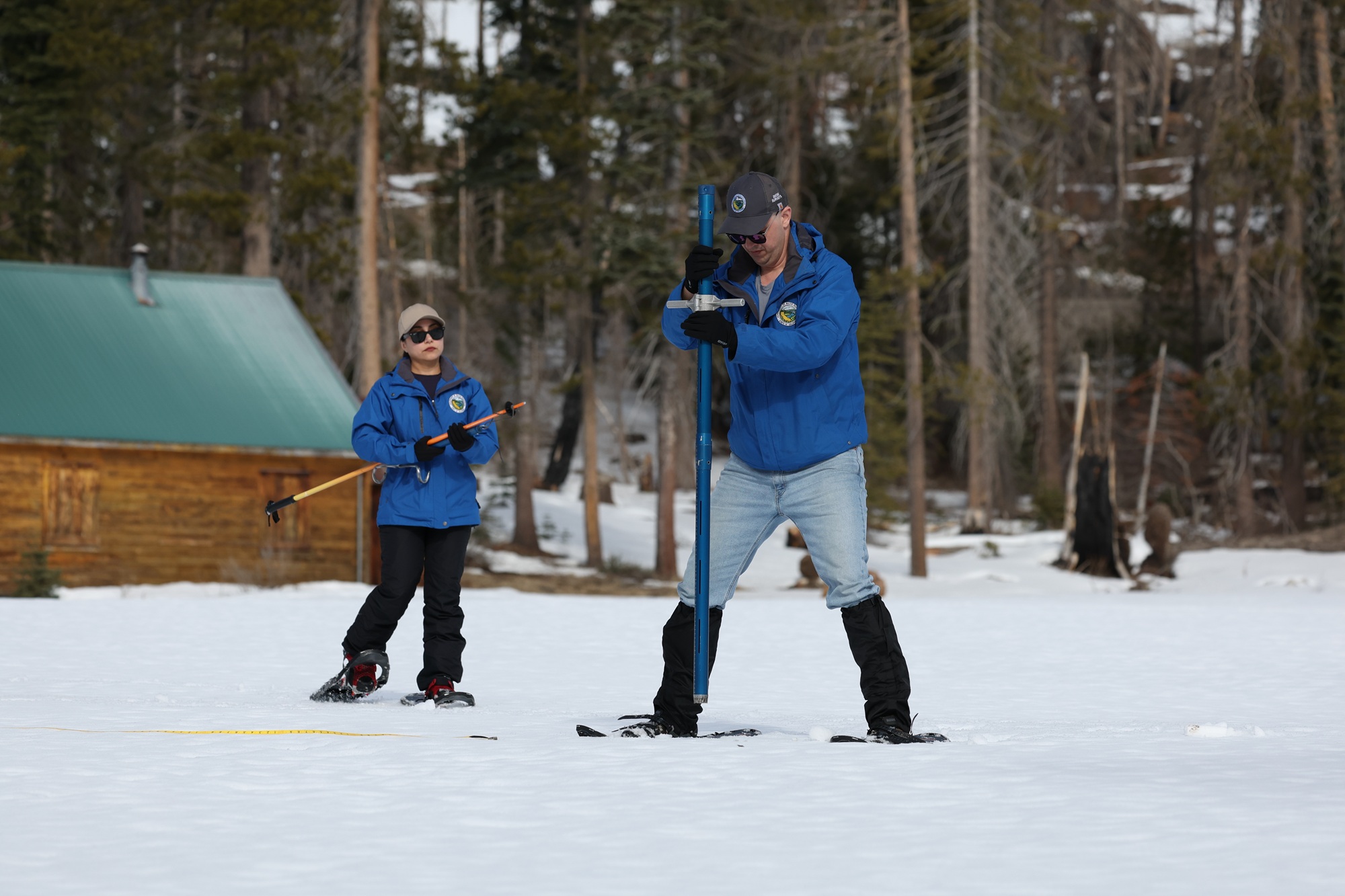
2 weeks agoShortening ski season: Sierra Nevada snowpack melting at 1% per day, officials say
A heat wave is rapidly melting Lake Tahoe's already-depleted snowpack at 1% daily, threatening to create the second-lowest April 1st measurement in history, with cascading impacts on water supply, wildfire risk, drought conditions, and ski season viability.
fromSFGATE
4 days agoHawaii storms produced enough rain to fill 3 million Olympic swimming pools
The powerful March storms that drenched Hawaii produced more than 2 trillion gallons of rain and pushed precipitation levels to as much as 3,000% above normal in a 14-day period for this time of year.
Environment
#california-water-crisis
Agriculture
fromwww.pressdemocrat.com
1 month agoLow snowpack, higher temperatures cause concern for Bay Area scientists, farmers
California needs significant March rain and snow to restore water resources after an unusually warm winter, despite February storms improving reservoir levels to 70-80% capacity.
Environment
fromLos Angeles Times
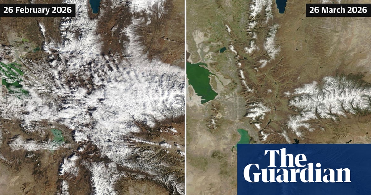
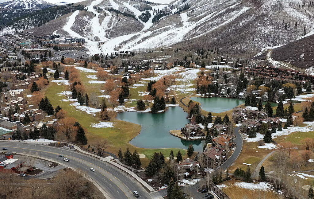
2 weeks agoCalifornia's snowpack was already meager. Now comes an extraordinary heat wave
California's Sierra Nevada snowpack is at 48% of average due to an extremely warm winter, with rapid melting accelerated by an incoming heat wave threatening the state's water supply.

California
fromsfist.com
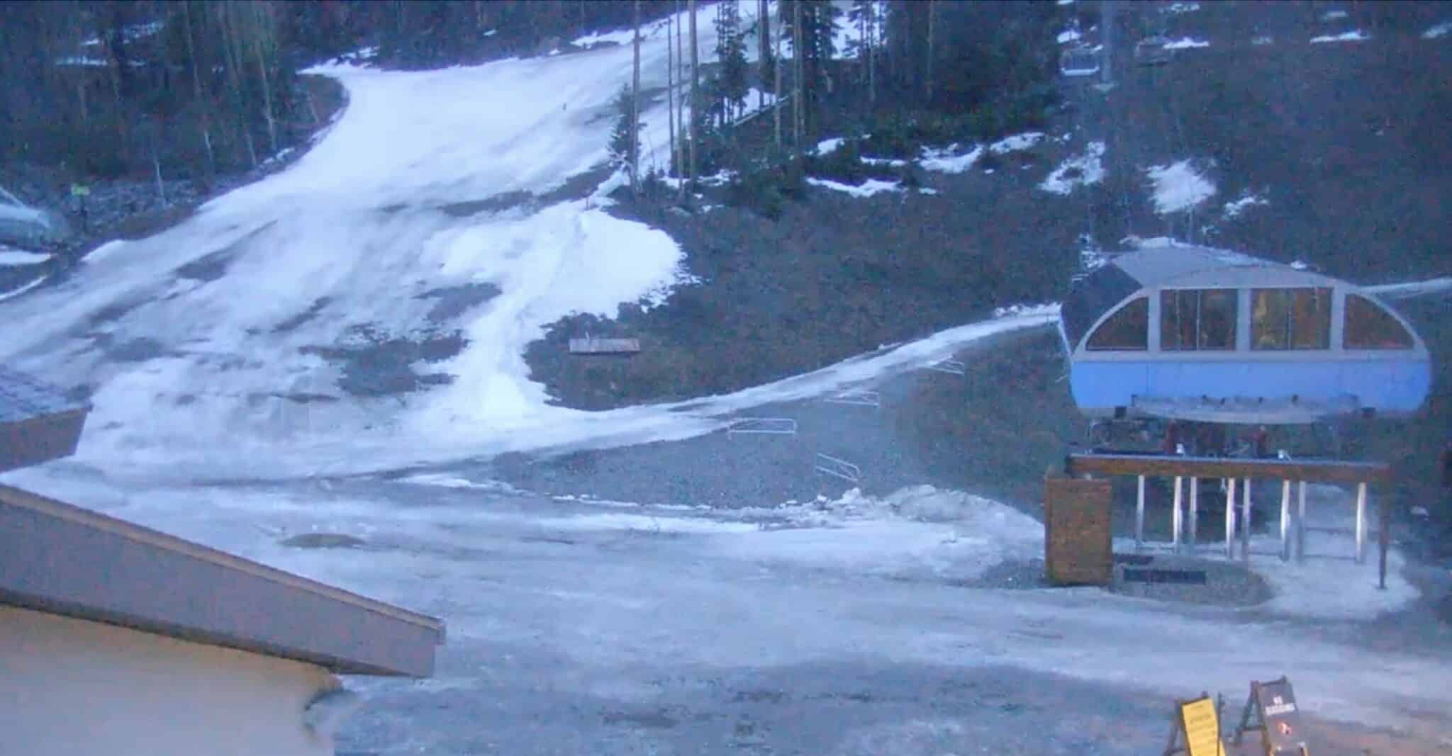
2 weeks agoThursday Morning What's Up: Ski Resorts Calling It Early Amid Snowmelt
Northern California ski resorts are closing early due to rapid snowmelt and warm temperatures, while regional political and business developments include SFPD pay increases, minimum wage ballot initiatives, and billionaire-backed gubernatorial campaigns.


Environment
fromThe Mercury News
1 month agoLow snowpack, higher temperatures cause concern for Bay Area scientists, farmers
March precipitation in higher elevations is critical for California's water security as snowpack remains significantly below average despite February storms and warm winter conditions.


California
fromThe Mercury News
1 month agoSierra Nevada snowpack just 68% of normal after whiplash winter, but water supplies are OK, experts say
California's winter weather has been extremely volatile, with alternating dry and snowy periods leaving the Sierra snowpack at 68% of historical average despite previous wet years filling reservoirs above normal levels.
Snowboarding
fromSnowBrains
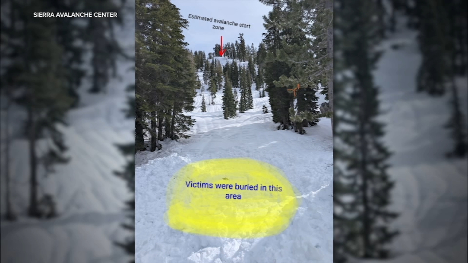
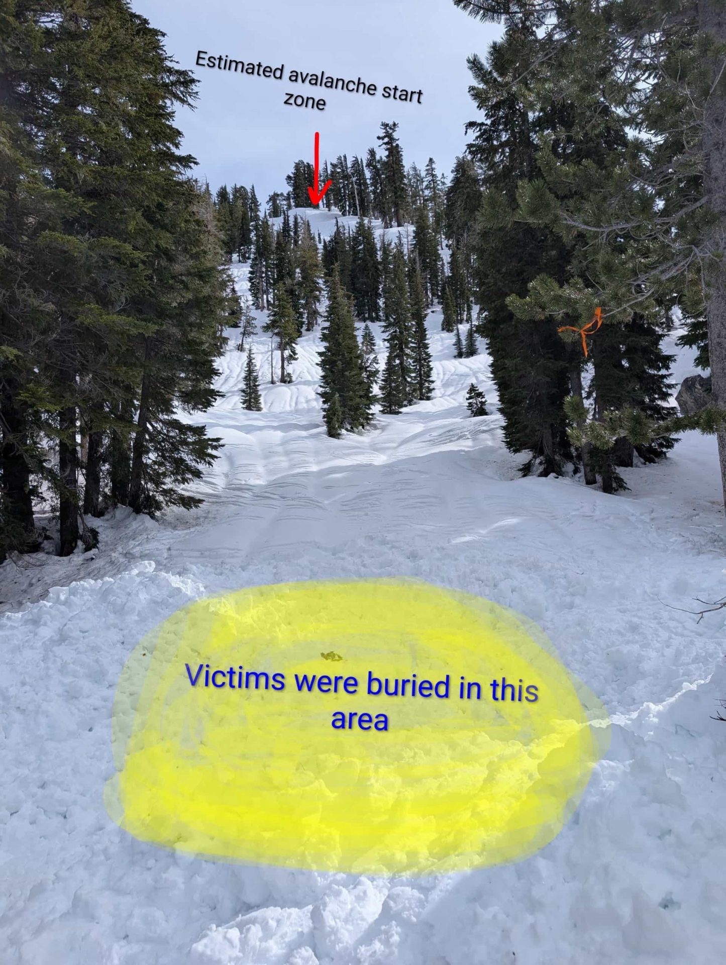
3 weeks agoThe Western U.S. Could See A Rare Wet Slab Avalanche Cycle Next Weekend - SnowBrains
A historic heat wave with temperatures 20-30 degrees above average could trigger rare wet slab avalanches in Colorado and Utah by introducing liquid water to weak layers in the snowpack.
fromSFGATE
1 month agoThe surprising element that's boosting California's stubbornly low snowpack
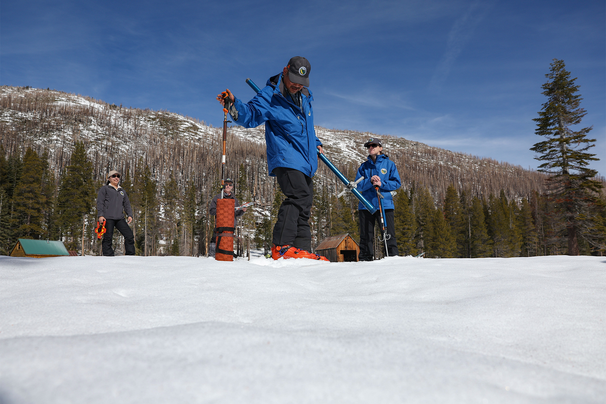
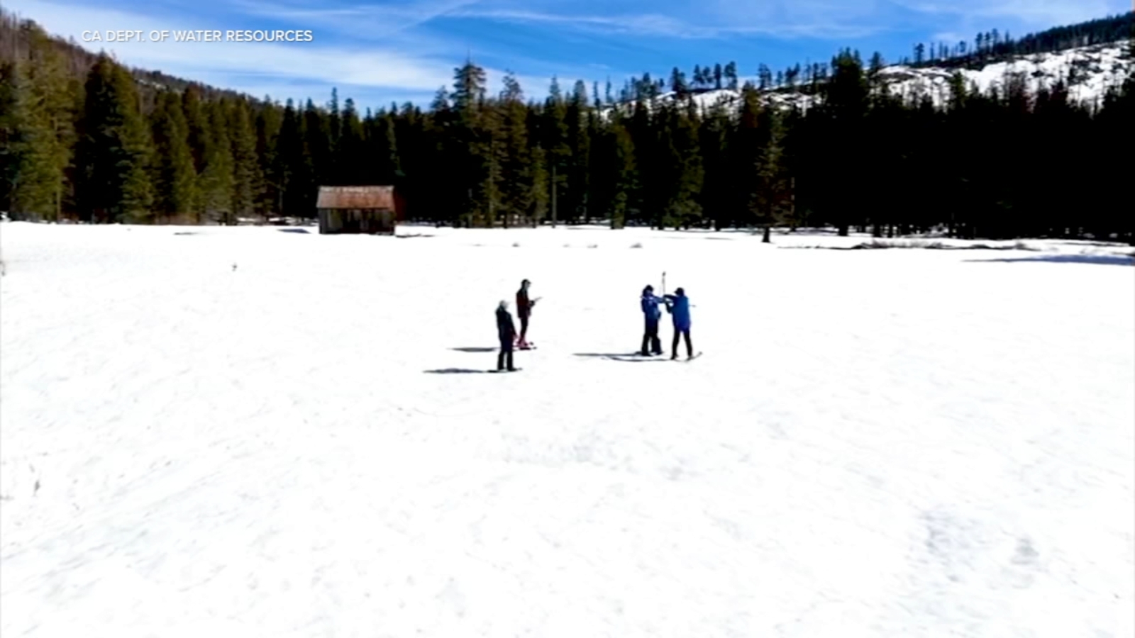
SWE is the most important metric for all of our water resources. It's the metric that we deal with the most and the one that the entirety of the snow research and operations community is working to get right. So, seeing an increase in SWE like that, even if it's from mid-winter rain, is a great thing because that means we have more water stored in the snowpack moving forward.
California
Snowboarding
fromSnowBrains
3 weeks agoSnowBrains Forecast: Mostly Dry, Springlike Stretch for the California Sierra - SnowBrains
California Sierra will experience dry, springlike conditions with no new snow through mid-March, featuring above-normal temperatures and firm mornings transitioning to softer afternoons.


Snowboarding
fromSnowBrains
1 month agoSnowBrains Forecast: A Dusting for the California Sierra Midweek, Then Dry and Warmer - SnowBrains
A weak midweek system brings light snow to California Sierra Wednesday-Thursday, followed by dry, warming conditions through the weekend with periodic ridge winds affecting exposed terrain.

Snowboarding
fromSnowBrains
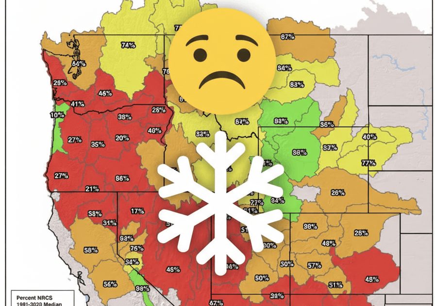
1 month agoMarch 2026 State of the Western U.S. Snowpack: Showing Slight Improvement But Still Below Average - SnowBrains
Western U.S. snowpack remains below average overall, with Oregon, Nevada, Arizona, and New Mexico severely depleted, while Eastern Sierra and Western Wyoming show stronger conditions.
fromLos Angeles Times
1 month agoA series of deadly California storms continues to bring more rain, snow and danger
Showers moving into the region from the Central Coast should bring steady rain to Ventura and Los Angeles counties Thursday morning, with frosty temperatures pushing snow levels lower than normal, potentially impacting commuters along the Grapevine, according to the National Weather Service. "Steady precipitation will taper off to showers by late this afternoon and become confined to the mountains by late tonight," the weather service posted in a Thursday morning forecast.
California
fromSnowBrains
1 month agoCan Colorado's Snowpack Catch Up? - SnowBrains
To get back to average snowpack, we essentially need to have the most snow that we've ever had for the last 30 years between now and mid-April. It would be extremely difficult for Colorado to get back to a normal/average snowpack. As an example, when looking at the Independence Pass SNOTEL site in central Colorado outside of Aspen, we typically have 13 inches of snow-water-equivalent at the end of February. This year, we only have 6.7 inches of SWE.
Snowboarding
fromSFGATE
2 months agoHistorically warm, dry January erases snowpack gains in Sierra Nevada
"A dry January, which is historically the wettest month of the year in California, has now eroded the gains made at the start of the year and forecasts currently show no major precipitation in the next two weeks," California Department of Weather Resources spokesperson Jason Ince wrote in a Jan. 30 news release. The first month of the year certainly left the area warmer and drier than usual, weather officials confirmed.
Environment
California
fromLos Angeles Times
1 month agoFirst wave of nearly a week of rain hits Southern California. Snow expected for Mammoth, Tahoe
Southern California experienced heavy rains with flood watches, wind advisories, burn-scar evacuation warnings, and forecasts of significant rainfall and mountain snow this week.
fromLos Angeles Times
2 months agoA 'breather': Drenched California has no dry areas for first time in a quarter-century
After experiencing one of the wettest holiday seasons on record, still soggy California hit a major milestone this week - having zero areas of abnormal dryness for the first time in 25 years. This data, collected by the U.S. Drought Monitor, is a welcome nugget of news for Golden State residents, who in the last 15 years alone have lived through two of the worst droughts on record, the worst wildfire seasons on record and the most destructive wildfires ever.
Environment
fromSnowBrains
1 month agoSnowBrains Forecast: Two More Feet for California This Week With Another Storm Brewing for Next Week - SnowBrains
Confidence is highest through Saturday because the individual models agree well on the timing of the Thursday storm and the following break. Southern California's mountains pick up a quick shot of snow on Thursday with strong winds, then dry out into the weekend. Beyond the weekend, the signal stays active, but model spread grows fast on storm timing, snow levels, and wind impacts, so expect meaningful swings from run to run.
Snowboarding
fromSnowBrains
1 month agoSnowBrains Forecast: Massive 8 Foot Storm Cycle Brewing for California Next Week - SnowBrains
Sun night (02/15) through Tue night (02/17) is the core punch, and many Sierra mountains can stack 20″-50″ in that window as snow levels crash. Expect a lighter start Sunday night, then snowfall rates ramp up hard Monday night into Tuesday with widespread coverage across Tahoe, the central Sierra, and down into Mammoth. Snow levels begin around 5,000 to 5,500 feet early, then fall into the 1,500 to 2,500-foot range by Tuesday and Tuesday night, which helps keep even lower terrain in play for all-snow.
Snowboarding
fromSnowBrains
1 month agoSnowBrains Forecast: Massive Storm Will Drop 100+ Inches on California This Week - SnowBrains
Two waves drive the bulk of the snow, with a relatively higher snow level and denser snow early, followed by a colder surge that improves powder quality and brings the strongest winds. Expect long stretches of snowfall for the Sierra with only brief lulls, plus periods of wind-driven, low-visibility skiing on upper mountain. Southern California gets meaningful mountain snow as well, but snow levels are a bigger deal there and the best accumulation favors higher terrain.
Snowboarding
[ Load more ]