#gps-integration
#gps-integration
[ follow ]
Business intelligence
fromLondon Business News | Londonlovesbusiness.com
5 days agoWhy GIS matters in modern infrastructure and urban planning: Building smarter, future-ready cities - London Business News | Londonlovesbusiness.com
GIS is essential for effective urban planning, enabling data-driven decisions that enhance infrastructure and quality of life in rapidly growing cities.


fromSearch Engine Roundtable
4 days agoOpenAI ChatGPT Enables Location Sharing For More Localized Near Me Results
Users can now choose to share their device location so ChatGPT can provide more relevant information, such as local recommendations, news, and weather. Sharing your device location is completely optional and off until you choose to enable it.
Roam Research
Arts
fromThe Art Newspaper - International art news and events
2 weeks agoNew book shows why physical maps have an important role to play in our digital world
A cartography professor discovered 96 historically significant maps in a forgotten university archive, revealing cartography's vital role in preserving sociopolitical memory and demonstrating maps' importance beyond navigation.
fromRealagriculture
2 weeks agoTerraScout brings robot agronomic scouting to the farm
It can drive through the field and look at every square inch. We really honed our craft on model performance and detection with rocks, and now we've transitioned that into weeds. The robot uses a boom-mounted camera system to capture detailed imagery across the field. With eight cameras operating at 1 millimetre resolution, TerraScout can generate billions of data points per acre, allowing it to identify specific objects, including individual weeds.
Agriculture
fromThe Cipher Brief
2 weeks agoGPS Denied: Time to Upgrade
On February 28, ships navigating the Strait of Hormuz started appearing on tracking screens in places they couldn't possibly be. They appeared to be sitting on airport runways, parked on Iranian land, and clustered at nuclear power plants. More than 1,100 commercial vessels had their navigation systems scrambled in a single day following US-Israeli airstrikes on Iran, bringing a waterway that handles a fifth of the world's oil exports to a halt.
Science
frominsideevs.com
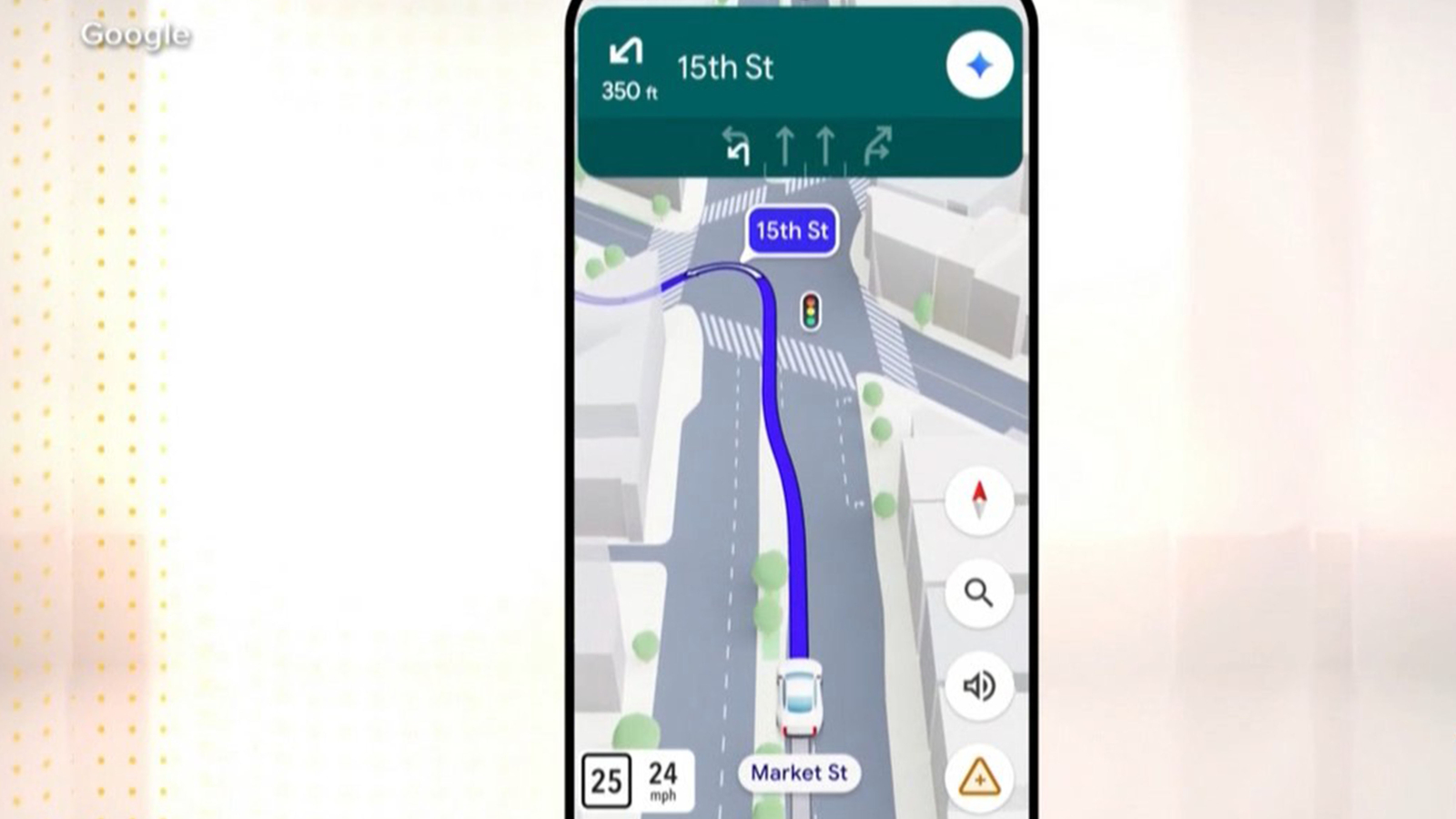
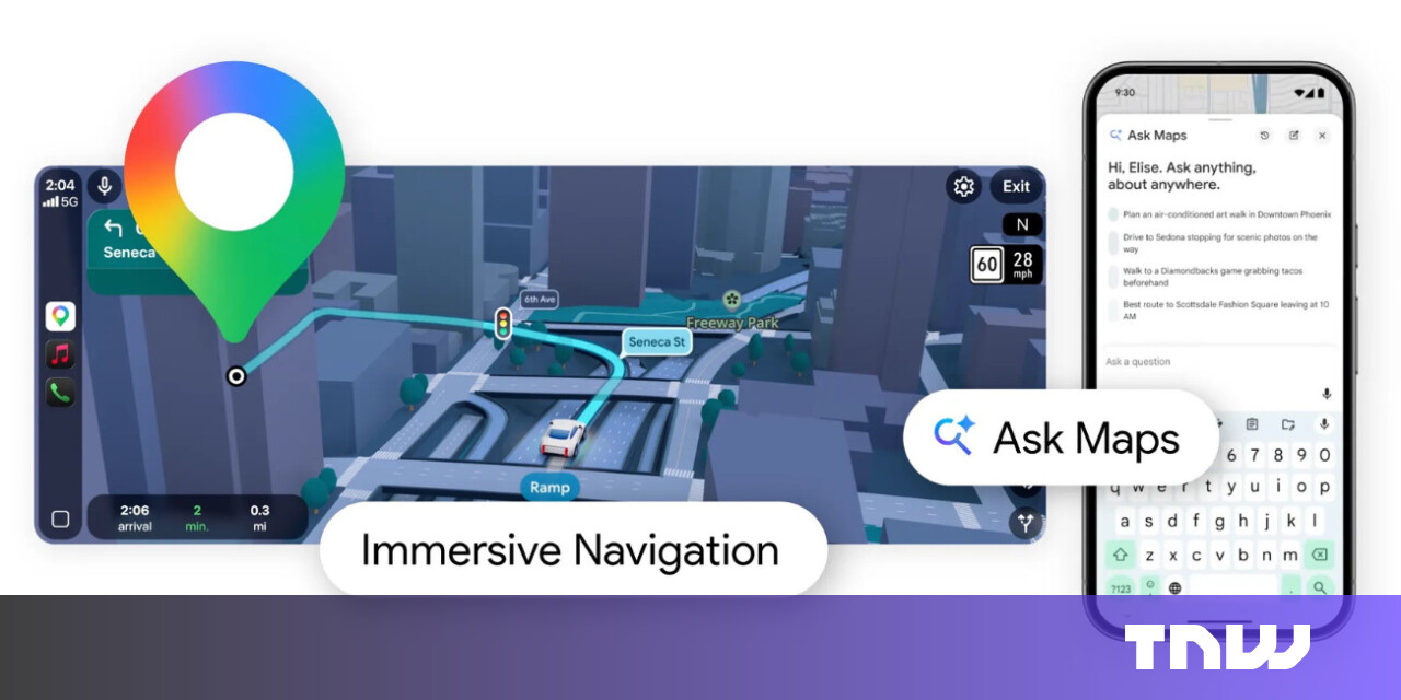
3 weeks agoGoogle Maps Is Getting 'The Most Significant Update' In Over A Decade
The new Immersive Navigation mode introduces a detailed 3D map that includes buildings, overpasses, crosswalks, traffic lanes, traffic lights, and stop signs. Google bills this new mode as being the most significant update in over a decade to the app's driving experience. According to the American IT giant, the changes should help drivers stay focused and informed on the road, with Maps giving fresh, real-world information and natural directions.
Gadgets
UK news
fromComputerWeekly.com
3 weeks agoUnreliable fleet connectivity driving employee exodus | Computer Weekly
UK fleet operators face significant connectivity challenges that threaten competitiveness, with unreliable networks causing customer complaints and operational disruptions despite limited failover protections.
Digital life
fromSilicon Canals
2 weeks agoThe generation that memorized phone numbers, gave directions using landmarks, and navigated by instinct built a relationship with the physical world that GPS and contact lists have made impossible to develop - and the thing they lost wasn't convenience, it was a form of spatial intelligence that made them participants in their environment instead of passengers - Silicon Canals
Reliance on digital navigation tools has diminished our spatial memory abilities and mental map-building skills, causing measurable changes in brain structure and cognitive function.


fromwww.dw.com
2 weeks ago'Vulnerable' satellites guide the world and its wars
Signals from Global Navigation Satellite Systems are quite vulnerable. They are exceptionally weak, meaning that any radio noise near their frequency, accidental or malicious, can interfere with reception. I am confident that there are people in every government who understand the problem. The challenge is getting leadership to both understand and act to reduce the risk.
Roam Research
fromZDNET
2 weeks agoThis tiny satellite device replaced my smartwatch while adventuring off-grid
The Garmin inReach Mini 3 Plus is a satellite communicator with touchscreen, longer battery life, improved antenna support, and a siren, offering better value than the Fenix 8 Pro watch for outdoor adventurers seeking safety and connectivity.
fromBikerumor
1 month agoKomoot Adds ChatGPT-Powered Route Discovery
Komoot has launched a ChatGPT integration that enables cyclists (and hikers, etc.) to discover routes through natural language queries. You can request specific routes by typing normal, conversational prompts and get curated recommendations from komoot's database of over 7 million routes and 4 million community highlights.
Bicycling
fromThe Verge
1 month agoAndroid's Find Hub adds iPhone-like luggage tracking links
Google is rolling out an Android update that includes the ability to share the location of your missing luggage with an airline. It's similar to the luggage-tracking feature Apple brought to the iPhone, allowing you to view the location of your Find Hub tag or accessory on a map, and provide your airline with a link to the information they need to track it down.
Gadgets
Gadgets
fromComputerWeekly.com
1 month agoConnectivity, AI drive fleet safety, productivity and decision-making | Computer Weekly
AI, connected data, and safety-focused services are transforming fleet operations, with GPS tracking adoption at record highs and AI delivering measurable safety improvements and cost reductions.
Software development
fromBusiness Matters
2 months ago5 Reasons Why Maptive is The Best GIS Platform for Location Intelligence
Maptive transforms spreadsheet location data into fast, browser-based interactive maps and optimized routes, delivering accessible location intelligence without specialized GIS expertise.
Data science
fromLondon Business News | Londonlovesbusiness.com
2 months agoIs Maptive the best mapping software to conduct complex spatial analysis - London Business News | Londonlovesbusiness.com
Maptive delivers cloud-based, no-code spatial analysis and mapping that handles large datasets, automated territories, route planning, and enterprise-grade global mapping infrastructure.


Agriculture
fromMedium
1 month agoLand Measurement App by Lumen Cluster: Measure Land Easily, Accurately, and Smartly
Smartphone-based Land Measurement App by Lumen Cluster enables fast, accurate, GPS-based land area calculations without specialized equipment, supporting multiple units for diverse users.
fromZDNET
1 month ago41 hidden Google Maps settings and features every power user should know
After writing about Google Maps for nearly 15 years, I've learned firsthand that it's packed with hidden settings, menus, and toggles. Many help you fine-tune the app to your liking, while others unlock new features you probably didn't know existed.
Roam Research

fromAdrelien | Meshtastic, IoT & Off-Grid Tech Guides
1 month agoWhy Your Meshtastic Node Sees More Satellites (GNSS Explained)
The other day we were scrolling through r/meshtastic and someone asks: "Why does my device show 10+ satellites in view while my buddy's barely sees 8?" Good question. Really good question, actually. And it's about to take us down a rabbit hole that involves atomic clocks, Cold War competition, European independence, and why your Meshtastic node cares about all of this.
Gadgets
fromEngadget
1 month agoHow to send a message via satellite on iPhone
Apple's satellite features were originally designed for emergencies, allowing iPhone users to contact emergency services when cellular and Wi-Fi coverage is unavailable. With recent versions of iOS, Apple has expanded those capabilities to include sending and receiving messages via satellite. This makes it possible to stay in touch with friends and family from remote locations where traditional networks do not reach, such as hiking trails, rural areas or offshore locations.
Apple
Artificial intelligence
fromeLearning Industry
2 months agoArtificial Intelligence In Transportation Training And Education
AI enables individualized transportation training by evaluating trainee performance, tailoring instruction, simulating real scenarios, and measuring performance for targeted improvement.
Gadgets
fromZDNET
2 months agoI've tried countless tracker tags, and these are the best I've found for Android
Rolling Square's AirNotch Pro Dual tags provide cross-platform Find My and Google Find Hub compatibility, durable IP68 construction, long battery life, omnidirectional sound, and built-in key attachment.
fromPeter-hoffmann
1 month agoGarmin Inreach Mini 2 Leaflet checkin map
We will be trekking the eastern part of the Great Himalaya Trail in Nepal in March/April. Details on the route and our plans can be found at https://greathimalayatrail.de. Our intent is to keep friends and family updated on our progress. Given that we'll be hiking in quite remote areas, a satellite phone/pager will be our sole means of communication. After the Garmin inReach Mini 3 was released recently, the Inreach Mini 2 was on heavy sale.
Gadgets
[ Load more ]