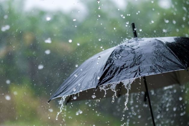
#yellow-rain-warnings
#yellow-rain-warnings
[ follow ]
#flooding #weather-warnings #reproductive-rights #climate-change #weather-warning #journalism-funding #weather


fromFast Company
2 days agoSee it: Air temperatures and pollution around the world are captured in real time in these animated weather maps
We created Earth in Action to provide a lens into what's happening on our planet, as it happens. Whether it's something typical, like the current air temperature, or an extreme event like a major dust storm, we wanted to provide an opportunity for people to see them.
OMG science


fromABC7 San Francisco
6 days agoBay Area weather radar network aims to improve storm forecasting, flood prep and drought planning
"This is going to help fill that gap in minutes to hours lead time that's vital to know where the heaviest rain is going to hit," Ralph said. "And when and what communities are going to be affected so people in the preparedness community and water resource management community can take action to help protect people's lives and property."
San Francisco


fromSFGATE
2 days agoHawaii storms produced enough rain to fill 3 million Olympic swimming pools
The powerful March storms that drenched Hawaii produced more than 2 trillion gallons of rain and pushed precipitation levels to as much as 3,000% above normal in a 14-day period for this time of year.
Environment
fromMail Online
3 weeks agoHazardous weather alert for 200 million as megastorm barrels across US
The storm from Sunday into Monday has the potential to become a bomb cyclone, which occurs when central pressure drops at least 0.71 inches of mercury (24 millibars) in 24 hours or less. That rapid strengthening would generate an expansive and intense wind field.
Chicago
France news
fromwww.theguardian.com
3 weeks agoWeather tracker: Southern France under yellow alert after severe thunderstorms
Severe thunderstorms in southern France produced record rainfall, the Gapeau river flooded, Illinois reported a potential hail size record, and South Africa experienced record-breaking March heat from high pressure.


fromIrish Independent
1 month agoMet Eireann's new localised weather warning system aimed to be in place later this year
Met Éireann is progressing in the area of more localised weather warnings, via the use of polygons to represent areas under warnings. This will mean a move away from county-based warnings to a sub-county-based warning approach, which will identify where the expected impacts will be in the county.
Miscellaneous
#weather-warning
Europe news
fromIrish Independent
3 weeks agoMet Eireann issues Status Yellow rain warning for 21 counties and nationwide wind warning
Status Yellow rain and wind warnings are in effect across Ireland Thursday, with heavy rain, flooding, difficult travel conditions, and potential snow at higher elevations.

Europe news
fromIrish Independent
1 month agoMet Eireann signals 'split' in weather fortunes this week with four counties under status yellow rain warning
Met Éireann issued a Status Yellow rain warning for Cork, Kerry, Galway, and Mayo, with Ireland experiencing a northwest-southeast weather split featuring wetter conditions in the northwest and drier conditions in the southeast.

Europe news
fromIrish Independent
3 weeks agoMet Eireann issues Status Yellow rain warning for 21 counties and nationwide wind warning
Status Yellow rain and wind warnings are in effect across Ireland Thursday, with heavy rain, flooding, difficult travel conditions, and potential snow at higher elevations.
Europe news
fromIrish Independent
1 month agoMet Eireann signals 'split' in weather fortunes this week with four counties under status yellow rain warning
Met Éireann issued a Status Yellow rain warning for Cork, Kerry, Galway, and Mayo, with Ireland experiencing a northwest-southeast weather split featuring wetter conditions in the northwest and drier conditions in the southeast.
Europe news
fromIrish Independent
3 weeks agoMet Eireann issues status yellow wind warning for three counties, while entire country under wind warning later in the week
Rain and showers occur daily this week with temperatures dropping to 0-4 degrees Thursday, accompanied by strong winds and potential wintry hazards.
fromMail Online
1 month agoThink this is bad? Scientists warn Britain is about to get BLOOD RAIN
Britain is about to be hit with showers of 'blood rain', according to experts from the Copernicus Atmosphere Monitoring Service (CAMS). This is thanks to a plume of red Saharan dust, which is currently sweeping over Europe towards the UK. When this dust mixes with Britain's persistent rain, the precipitation will take on a distinctive reddish colour - creating a phenomenon known as 'blood rain'.
Miscellaneous


fromwww.npr.org
1 month ago'Please inform your friends': The quest to make weather warnings universal
In November 2025, a massive storm rolled across the lower Mekong River delta, dumping multiple inches of rain onto the wide, flat river plain that covers much of Cambodia. The river rose and rose. The force of the water churned up mud from the river bottom. The muddy water flowed downstream and rushed into the many farming and fishing towns that line the Mekong's banks.
US news


fromSilicon Canals
1 month agoThe one thing meteorologists wish people would stop doing before a winter storm hits - Silicon Canals
When I spoke with emergency management officials last year, they all mentioned the same frustrating scenario. People ignore storm warnings until the precipitation starts falling, then suddenly everyone rushes out at once. The roads become congested with anxious drivers, accidents spike, and stores run out of essentials just when people need them most. But here's what really gets meteorologists worked up about this pattern. Modern weather forecasting has become incredibly accurate, especially for major winter storms.
Public health
fromIrish Independent
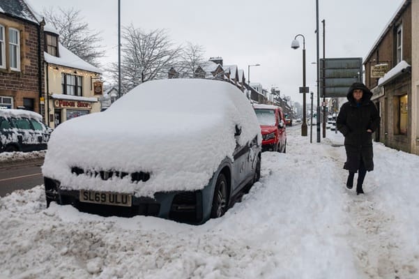
1 month agoMet Eireann issues snow, wind and rain warnings for 12 counties with more flooding and disruption forecast
Wexford, Wicklow, Dublin, Meath and Louth will be under a Status Yellow wind warning and Met Éireann are warning of fallen trees and loose debris, as well as difficult travelling conditions associated with this warning. Counties Cork, Waterford, Carlow, Kilkenny, Wexford, Wicklow, and Dublin will be under also be under a Status Yellow rain warning and these counties can expect flooding, poor visibility and difficult travel conditions for the 24-hour period.
Miscellaneous
UK news
fromLondon Business News | Londonlovesbusiness.com
2 months agoMet Office issues amber and yellow weather warnings for rain and wind - London Business News | Londonlovesbusiness.com
Heavy rain and strong winds will cause flooding, travel disruption, and potential community isolation across Scotland, parts of Northern Ireland, Wales, and southwest England.
fromIrish Independent
1 month agoMet Eireann expands last-minute thunderstorm warning to eight counties, as Ireland braces itself for another rainy weekend
Our weather is set to stay unsettled for the next little while with more rain, showers and blustery conditions to come, Though it will turn milder as we head into the weekend with warmer than average temperatures for this time of year. As we head into next week then staying mild and quite breezy with further outbreaks of rain on both Monday and Tuesday,
Environment


fromwww.theguardian.com
2 months agoWeather tracker: Canada issues warnings for freezing rain, heavy snow and strong winds
Atlantic Canada is under widespread weather warnings for snow, freezing rain and strong winds as a winter storm moves across the region. In Newfoundland, up to 40cm of snow fell on Sunday, along with wind gusts of about 74mph, creating blizzard-like conditions. The storm began late on Sunday and is forecast to persist until Tuesday morning. Freezing rain warnings are in place across Nova Scotia, including Annapolis and Kings counties,
Miscellaneous

fromIrish Independent
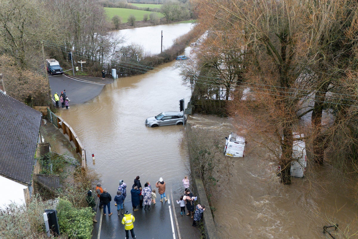
1 month agoMet Eireann changes Orange and Yellow rain warnings for 13 counties as flood threat peaks and travel disruption hits
LATEST: More homes and businesses at risk as flood threat to peak this morning Series of Status Orange and Yellow warnings in place Coast Guard has asked public to stay away from waterways and exposed coastal areas Some schools may close today as flooding may affect transport The threat of flooding is set to peak this morning, with road networks expected to bear the brunt of the deluge. However, damage to residential and commercial properties is also likely, emergency services have warned.
Miscellaneous
fromIrish Independent
1 month agoSevere flooding disruption as forecasters issue last-minute rain warning; winter to bite hard as ice, frost and snow due in coming days
"It will prove cold with some frost and ice in places on Friday morning, especially in the west and north," she said. "Munster and south Leinster will see cloud, but that will clear to leave dry and sunny conditions with a few isolated showers in the north and highest temperatures of 3C to 7C," she said. Friday night will prove mainly dry but very cold and frosty with some icy patches.
Environment
Environment
fromLondon Business News | Londonlovesbusiness.com
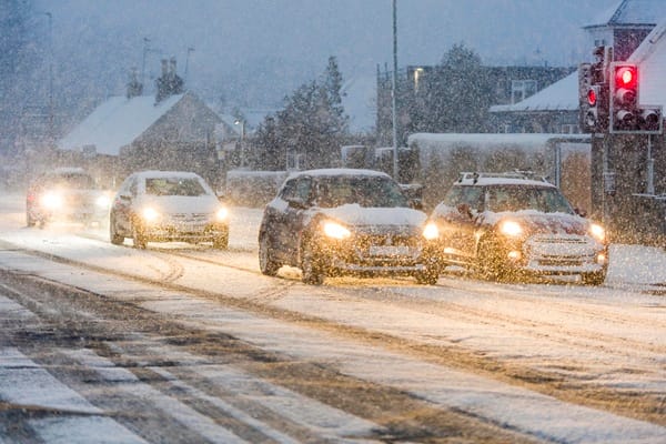
2 months agoMet Office issues a 'string of four Amber warnings for snow' - London Business News | Londonlovesbusiness.com
Amber snow warnings affect northern Scotland while yellow snow and ice warnings span much of the UK, bringing snowfall, ice, travel disruption, and increased health risks.
Environment
fromLondon Business News | Londonlovesbusiness.com
2 months agoMet Office warns Storm Chandra 'will bring a range of hazards to the UK' - London Business News | Londonlovesbusiness.com
Storm Chandra will produce strong easterly winds, heavy rain and hill snow, causing flooding, wind impacts and travel disruption across affected UK regions Monday night into Tuesday.
[ Load more ]